Bar Z Tentative Parcel Map

[smartslider3 slider=2]
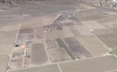
Santa Ynez


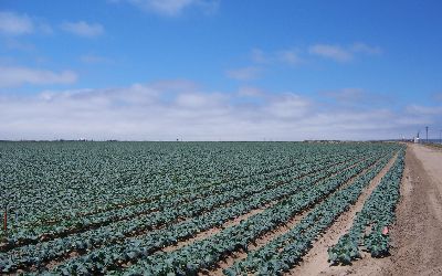
Bar Z Tentative Parcel Map was a two way lot split for estate planning purposes on 610 acres creating two 305 acre parcels near Los Olivos on the Santa Ynez Valley. The County maintains strong protective measures for agricultural viability. UPC provided in depth analysis of agricultural and biological resources and designed the lot split so as to successfully negotiate with the county minimal conditions as part of the lot split greatly minimizing costs to the client.

Duncan Farms Agricultural Expansion

Cuyama


Duncan Family Farms of Goodyear, AZ, retained RPS to help convert a 678 acre prior horse training facility into an organic farming operation. RPS evaluated the property and determined most of the parcels were not legal as well as most of the structures present. Due to the substantial timing issues for planting to make crop harvest schedules, RPS developed a comprehensive permitting strategy to facilitate expedited parcel validity and legalization of desired structures so as not to impede harvest schedules. RPS successfully negotiated the permit approvals with County staff in order for Duncan Farms to plant and harvest their rotational crops on time. RPS also successfully permitted a loading facility in the same time concurrent with the legalization. RPS is now working with the client to develop employee housing, administrative offices, and a cooler facility on site.

Tespusquet BLM Hiatus

[smartslider3 slider=3]

Tepusquet


RPS was retained by landowners in the Tepusquet area to help in resolving boundary discrepancies between their properties and federal lands managed by the Bureau of Land Management (BLM). The landowners had tried for over 40 years to regain a total of 380 acres deemed federal lands due to surveying errors with no success. RPS worked with the BLM and the 24th Congressional District to utilize existing federal laws to arrange for the processing of the land acquisition including all NEPA assessment and appraisal costs being covered by the federal government. RPS assisted in the granting of multiple patents per the desires of the landowners for maximum value of the property.

Grubstake Lot Line Adjustment

Santa Maria Valley


Grubstake Lot Line Adjustment. LLA of an adjustment of two parcels totaling over 465 acres to be roughly equal in size per a court order on agricultural row crop lands in the Santa Maria Valley. RPS assessed the agrilcutural viablity of the adjustment and negotiated with the county to declare the project exempt rom CEQA and received approval within 6 months of application submittal.

Twitchell Dam Sediment Removal

[smartslider3 slider=4]

Santa Maria


RPS is serving as Project Manager for the Santa Maria Water Conservation District to manage the District’s Sediment Removal Project at Twitchell Dam. Due to historic fires and resulting flooding, the dam is impacted by substantial sediment buildup in the spillway and downstream channel which will impact future releases and could pose potential threats to Santa Maria and Guadalupe. RPS developed and implemented the District’s Emergency Declaration coordinating various federal, state, and local agencies involvement including Section 7 consultations with the US Army Corps of Engineers so that removal operations can begin.

RPS recently completed the District’s annual Maintenance Plan and is currently processing the necessary federal and state permits to authorize the plan.